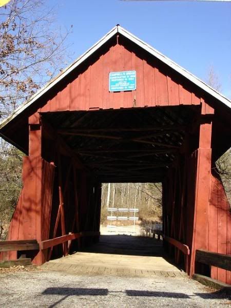
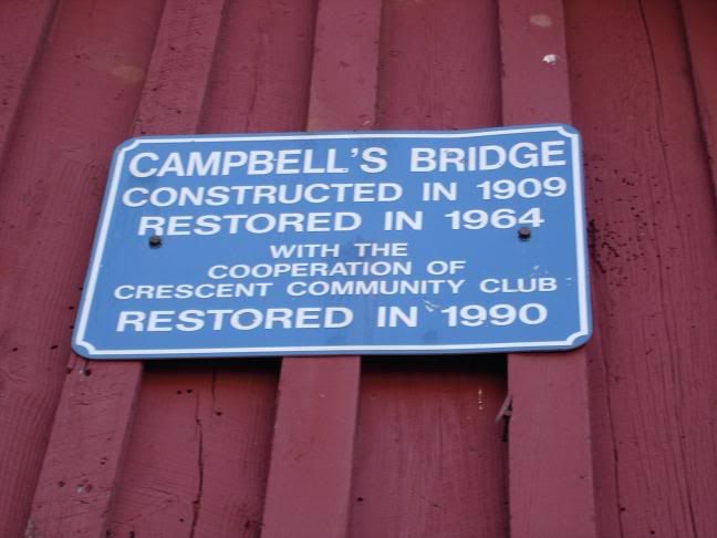
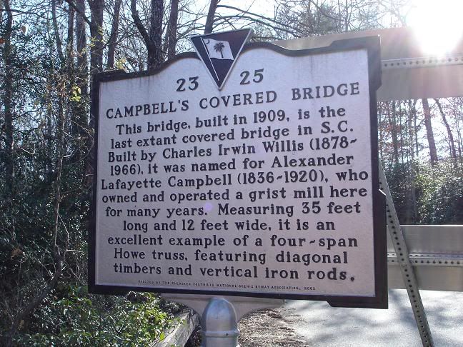
I kept looking and Byways.org lists Campbell's Covered Bridge as a historic attraction. Basically it's the last remaining covered bridge in South Carolina. Sounds interesting enough, now I've got a road, and a destination!
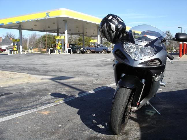
10am, ready to roll out:
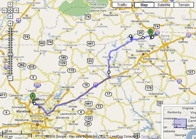
I originally wanted to ride up through Dahlonega and run some side roads into South Carolina. But there really isn't a straightforward way to get to Exit 1 on I-85 from there. At least not one that gets me there relatively quick. So I make it a bit boring by heading up I-85 into South Carolina.
Finally make it to the SC border and immediately get onto SC-11, the Cherokee Foothills Scenic Highway. Maybe not quite immediately enough as I quite literally passed the exit. D'oh. Once I get back on track it's nothing special really as far as the road goes. Not really twisty but there's lotta interesting things on the sides of the roads to look at. Definitely out in the middle of nowhere in some parts.
There are some good roads right off of SC-11 though. 178 looked pretty twisty on the map and at the intersection there was a group of sportbikes at the gas station who looked like they were ready for some fast paced riding.
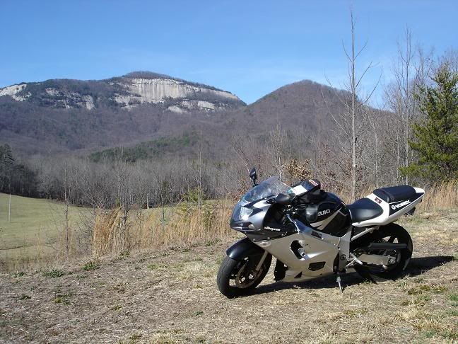
Just after that is Table Rock, which kinda looms over your shoulder it seems, and I couldn't help but turn around to get this pic:
Shortly after Table Rock is Caesars Head state park, and the road that goes through it, US-276, looked pretty brutal. May have to make a detour on the way back and check this one out!
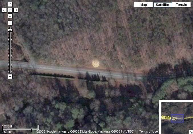
There was a wierd smiley face painted on some rocks on the side of the road past Caesars Head, kinda made me do a double take. I found it on Google Maps:
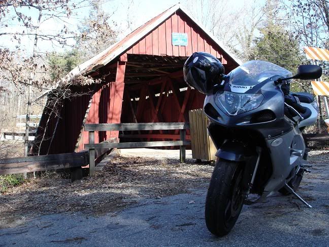
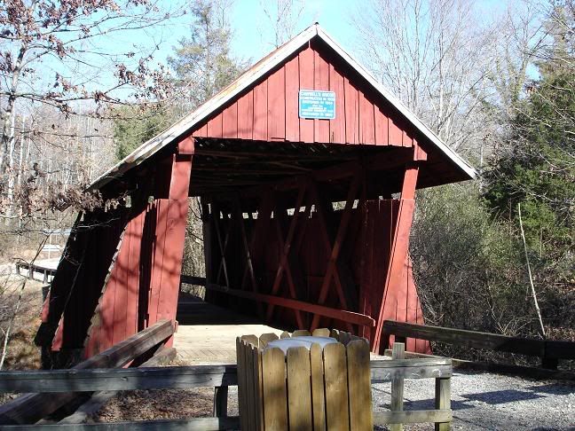
Finally make it to the destination, get on some real rough side roads and make it to the covered bridge:
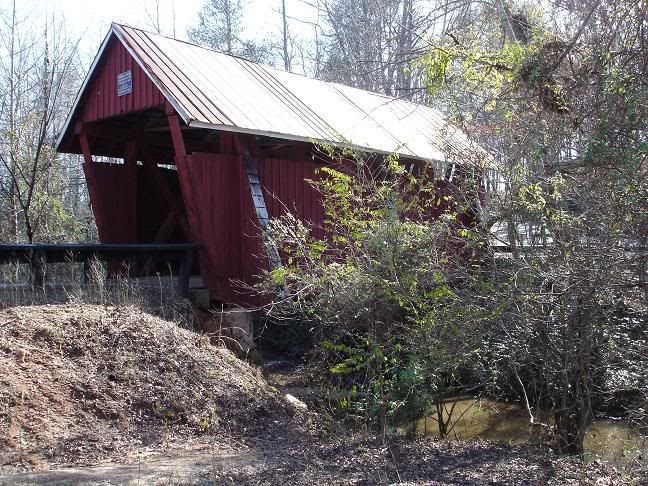
I was hoping to actually ride through it, but there were some DOT type signs blocking the entrance. Understand tho since it's not really used anymore. I would have really like them to use a sign that didn't look so bad though. I probably could have squeezed the bike by but probably wouldn't have been pretty respectful, so I decide against it.
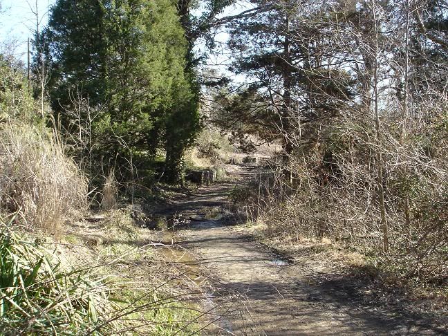
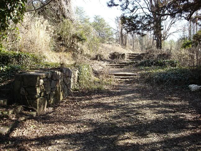
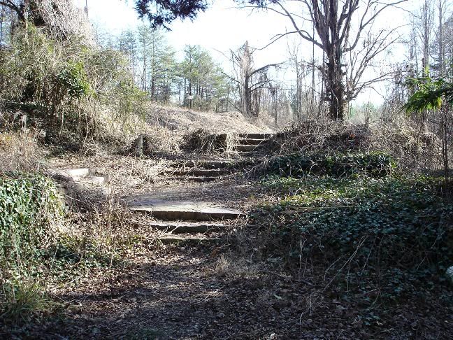
There was a path next to the road that looked like it may have been the original footpath used in the early 1900's when it was built. There was a boarded up water well and some steps. And a lot of mud. That I didn't see. Until I stepped in it. Did I mention the mud was really deep?

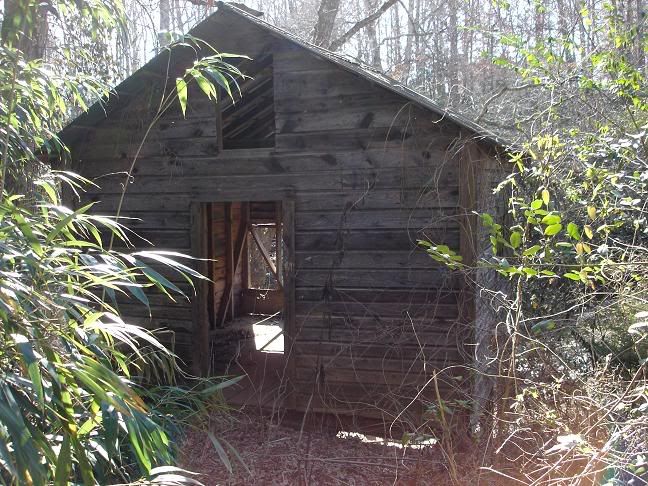
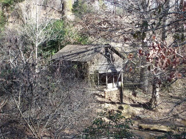
There was a shack right off of the footpath, it was in surprisingly good shape for it's age. I wanted to actually get inside it, but I figured the only thing that could come of that would be me surprising the hell out of a poor homeless guy or falling through the floor into the creek. I thought that may actually make my ride more interesting, so I go for it:

At this point, ankle deep in mud, I realize I'm being dumb. I stop here, change my mind, this is as close as I want to get now:
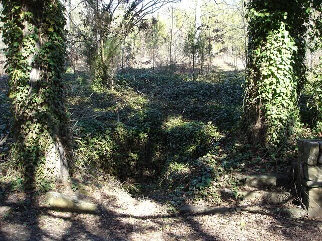
"Untouched" would be an understatement:
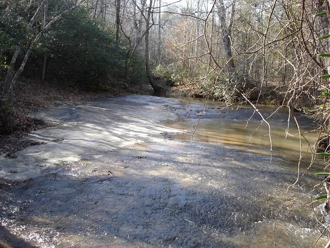
This is the creek that the bridge goes over:
There seems to be some more stuff on the other side so I make my way back over there. There are a handful of houses right close to the bridge here on this side.
A shot of the shack from across the river:
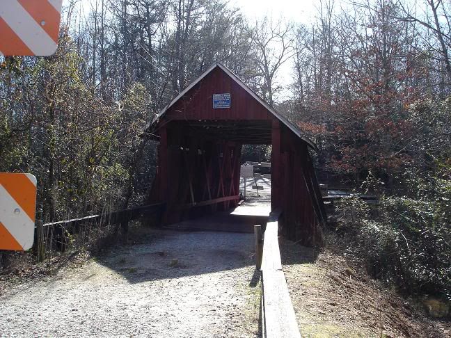
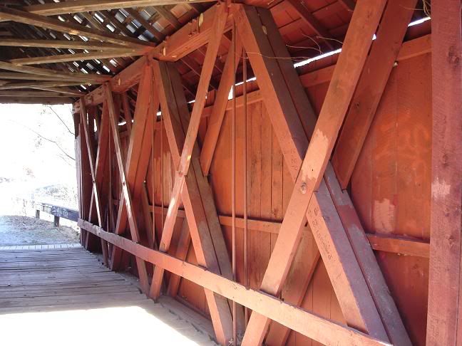
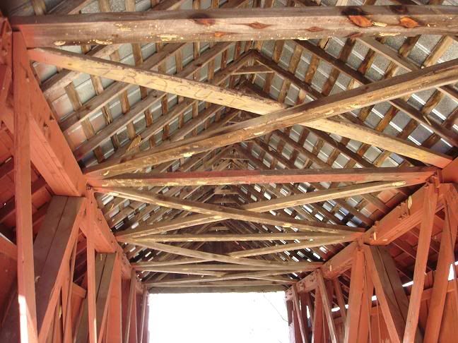
Unfortunately it looks like there was a lot of vandalism here inside the bridge, some of it has been painted over but the "carvings" are still there:
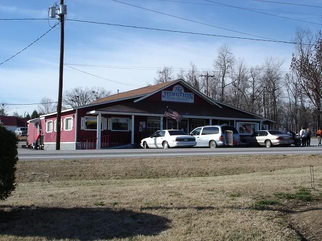
Head back to the gas station at the corner of SC-11 and SC-14, just a couple miles from the bridge.
There are a BUNCH of bikes around on this intersection. Lotta cruisers and some sportbikes, and few in full leathers. There must be some more twisty roads pretty close to here.
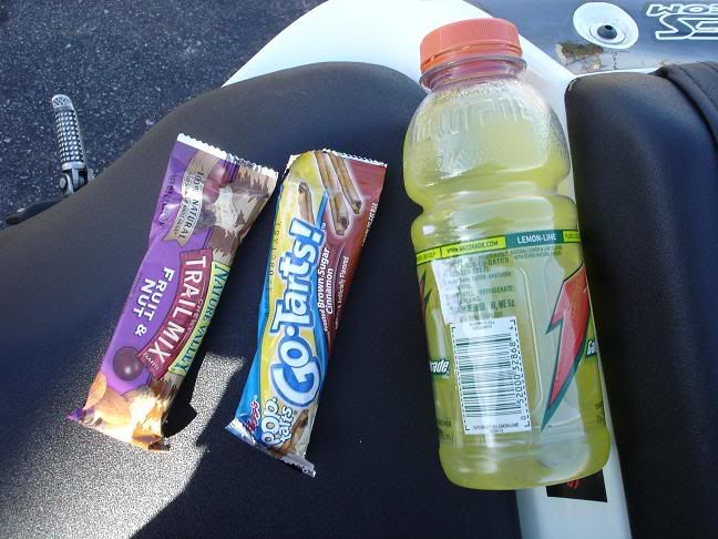
This place across the street had the whole area smelling good, definitely some good country cooking inside. "The Junction Home Cooking":
Which really sucked because this was my lunch, doesn't quite compare I think:
Head back the way I came, and get back to Caesars Head State Park and decide to see if this is as twisty as the map suggests:
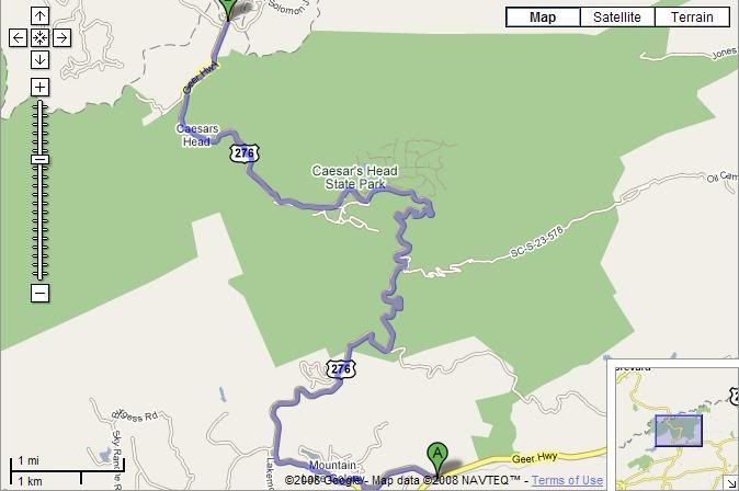
And it was! Pretty fun little road actually. Real tight in some spots. There were a good amount of sport bikes and it was kinda like 129 there. Make it all the way into North Carolina and turn around to get back on 11 to continue home.
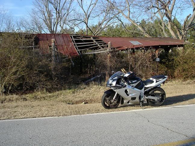
A few miles short of getting back on I-85, I see an old run down shed just a bit down a side road that caught my eye on my way earlier, so I decide to check it out and maybe get a shot of it:
I continue down this side road and see an old building that was worthy of a picture:
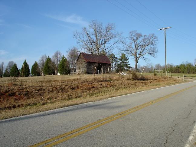
Some of the buildings off of this road really make it feel like it's 100 years ago as you ride past them.
Make my way back to SC-11 again and finally get back on I-85, then back home.
Probably just over 400 miles total.